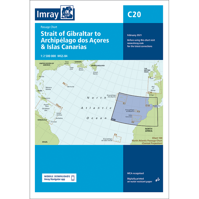
Imray Chart C20: Strait of Gibraltar to Archipélago dos Açores & Islas Canarias Passage Chart
| Edition: | 2021 |
|---|---|
| Corrected to: | February 2024 |
| Scale: | 1 : 2,500,000 |
| Format: | Water-resistant paper chart in A4 plastic wallet |
| Size: | 787 x 1,118 mm |
Imray Chart C20: Strait of Gibraltar to Archipélago dos Açores & Islas Canarias Passage Chart - 2021 / February 2024 is backordered and will ship as soon as it is back in stock.
Couldn't load pickup availability
Delivery Information
Delivery Information
We aim to dispatch all orders by the next business day, but we're a small business and sometimes when it's busy it may take a little bit longer. If there's going to be any delays we'll get in touch and keep you up-to-date.
Shipping is free for all orders of £50 or more!
We work with Royal Mail, DPD and DHL to offer the most convenient delivery options to our customers.
Friendly Advice
Friendly Advice
Chris is a Master Mariner and knows a thing or two about seafaring. If you need any help then don't be shy - send us an email or get in touch using the WhatsApp icon.
Easy Returns
Easy Returns
Not what you were looking for? No problem. We can accept returns of items in as-sold condition for up to 30 days (maybe a bit longer but don't tell anyone).
Just let us know and we'll sort everything out, including the shipping cost back to us.
Unfortunately this doesn't apply to Print on Demand charts as they are correct at the time of printing.
Of course if there's any faults or damage then let us know and we'll make it right!
Explore with Imray
A passage chart designed for planning and navigating across the North Atlantic between Gibraltar, the Azores and the Canary Islands.
Based on official Hydrographic Office Digital with additional information from across Imray’s network, tailored to appropriate scales and level of Digital for leisure sailors. Imray’s award-winning cartography includes a familiar, logical colour scheme, coloured light sectors and fine overprinted latitude and longitude grids to make plotting easier.
On this edition the magnetic variation curves have been updated with the latest Digital. There has been general updating throughout.
About Imray C Series Charts
Imray C Series charts cover cruising grounds around Britain, Ireland, and Northwest Europe. They're scaled for planning and passage-making: larger than harbour charts, but detailed enough for inshore work. Each chart unfolds to 787 × 1,118 mm, giving you room to see the bigger picture without carrying dozens of sheets. They're printed digitally on Pretex, a synthetic paper that tolerates salt spray and damp conditions. Charts are supplied folded to A4 and packed in a durable plastic wallet. If you need unfolded charts, just get in touch. We can arrange that with a 7-10 day lead time.
These are working charts for anyone who navigates seriously: cruising crews, motor boaters, fishing vessels, and commercial operators alike. Imray C Series charts are recognised by the Maritime and Coastguard Agency for use on coded and fishing vessels up to 24 metres. Whether you're plotting a coastal passage, planning next season's cruise, or keeping current charts to hand, C charts give you what you need at a practical scale. Imray publishes other chart ranges for different waters: M Series for the Mediterranean, G for Greek waters, Y for UK harbours and estuaries, A, B, D and E (Imray-Iolaire) for the Atlantic and Caribbean, plus chart packs covering key cruising areas.
About Imray
Imray has been publishing nautical information for recreational and professional mariners since the mid-18th century. Originally a family business, the company retains continuity through generations of maritime knowledge. Today, Imray is part of FB Imray, a joint venture with freytag & berndt (Austrian cartographic specialists). This has allowed them to combine traditional expertise with modern production methods.
Imray is recognised by the Maritime and Coastguard Agency as a chart producer. Their portfolio extends beyond paper charts to include pilot books, cruising guides, almanacs, and navigation handbooks.
-
Edition
-
Corrected to
-
TypePassage
-
Scales1 : 2,500,000
-
Format
-
Size
-
Pages
-
ISBN
Payment & Security
Payment methods
Your payment information is processed securely. We do not store credit card details nor do we have access to your credit card information.

