Sitemap
Can't find what you're looking for? See our site map for a list of our pages.
Products
- Weems & Plath Elegant Navigation Set
- Weems & Plath 24" Parallel Rule
- NAVBasics (3 book set)
- Ship Stability OOW
- Flip Cards: IALA Bouyage (Region A)
- Flip Cards: IALA Bouyage (Region B)
- Flip Cards: Rule of the Road
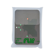
- Flip Cards: Lights and Shapes
- Flip Cards: Morse Code
- Flip Cards: GMDSS Marine Radio
- Weems & Plath ROADrule™ IALA Buoyage
- Flip Cards: Meteorology
- Weems & Plath 18" Parallel Rule
- Weems & Plath 15" Parallel Rule
- Weems & Plath 12" Parallel Rule
- Weems & Plath LIGHTrule™
- Weems & Plath ParaLock Plotter
- Weems & Plath Parallel Plotter
- Seamanship Notes
- Admiralty Small Craft Charts - 5600 - The Solent and Approaches
- Admiralty Small Craft Charts - 5601 - East Devon and Dorset
- Admiralty Small Craft Charts - 5602 - Falmouth to Teignmouth
- Admiralty Small Craft Charts - 5603 - Falmouth to Hartland Point
- Admiralty Small Craft Charts - 5604 - The Channel Islands
- Admiralty Small Craft Charts - 5605 - Channel - Chichester to Oostende
- Admiralty Small Craft Charts - 5606 - Thames Estuary, Ramsgate to Canvey
- Admiralty Small Craft Charts - 5607 - Thames Estuary, Essex and Suffolk
- Admiralty Small Craft Charts - 5608 - Bristol Channel
- Admiralty Small Craft Charts - 5609 - North West Wales
- Admiralty Small Craft Charts - 5610 - The Firth of Clyde
- Admiralty Small Craft Charts - 5611 - West Coast of Scotland
- Admiralty Small Craft Charts - 5612 - Northern Ireland
- Flip Cards: CEVNI Signs and Lights
- Admiralty Small Craft Charts - 5613 - Irish Sea, East Part and Isle of Man
- Flip Cards: International Code Flags
- Admiralty Small Craft Charts - 5614 - East Coast, Orford Ness to Whitby
- Admiralty Small Craft Charts - 5615 - East Coast, Whitby to Edinburgh
- Admiralty Small Craft Charts - 5616 - West Coast of Scotland and Outer Hebrides
- Admiralty Small Craft Charts - 5617 - East Coast of Scotland
- Flip Cards: Sound and Light Signals
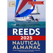
- Reeds Nautical Almanac 2025
- Admiralty Small Craft Charts - 5620 - South West Wales
- Admiralty Small Craft Charts - 5621 - Ireland, East Coast
- Admiralty Small Craft Charts - 5622 - Ireland, South, Waterford to Kinsale
- Admiralty Small Craft Charts - 5623 - South West Coast of Ireland
- Reeds Channel Almanac 2025
- Reeds Eastern Almanac 2025
- Reeds Western Almanac 2025
- Weems & Plath 8" One Hand Brass Divider
- Weems & Plath 7" Straight Pattern Brass Divider
- Weems & Plath 8" Straight Pattern Brass Divider
- Weems & Plath 7" One Hand Brass Divider
- Imray Chart Pack 2900: Firth of Clyde including passages to Northern Ireland
- Imray Chart Pack 2000: Suffolk and Essex Coasts
- Imray Chart Pack 2100: Kent and Sussex Coasts
- Imray Chart Pack 2200: The Solent
- Imray Chart Pack 2300: Devon and Dorset Coasts
- Imray Chart Pack 2400: The West Country
- Imray Chart Pack 2500: The Channel Islands
- Imray Chart Pack 2600: The Bristol Channel
- Imray Chart Pack 2700: North and West Wales
- Imray Chart Pack 2800: Kintyre to Ardnamurchan
- Imray Chart Pack 2510: North Brittany
- Imray Chart Pack 3200: Islas Baleares
- Imray Chart Pack 3210: Gibraltar to Cabo de la Nao
- Imray Chart Pack 3220: Cabo De La Nao to the French Border
- Imray Chart C1: Thames Estuary
- Imray Chart C65: Crinan to Mallaig and Barra
- Imray Chart C10: Western English Channel Passage Chart
- Imray Chart C15: The Solent
- Imray Chart C20: Strait of Gibraltar to Archipélago dos Açores & Islas Canarias Passage Chart
- Imray Chart C24: Flamborough Head to Fife Ness
- Imray Chart C14: Plymouth Harbour and Rivers
- Imray Chart C2: The River Thames
- Imray Chart C18: Western Approaches to the English Channel & Bay of Biscay
- Imray Chart C12: Eastern English Channel Passage Chart
- Imray Chart C23: Fife Ness to Duncansby Head
- Imray Chart C19: A Coruña to Gibraltar
- Imray Chart C25: Harwich to River Humber and Holland
- Imray Chart C26: IJmuiden to Die Elbe
- Imray Chart C27: Firth of Forth
- Imray Chart C28: Harwich to Wells-next-the-Sea
- Imray Chart C29: Harwich to Whitby
- Imray Chart C3: Isle of Wight
- Imray Chart C30: Harwich to Hoek van Holland and Dover Strait
- Imray Chart C31: Dover Strait to Le Havre
- Imray Chart C32: Baie de Seine
- Imray Chart C33A: Channel Islands (North)
- Imray Chart C33B: Channel Islands (South)
- Imray Chart C34: Cap d'Erquy to Ile de Batz
- Imray Chart C35: Baie de Morlaix to L'Aber-Ildut
- Imray Chart C36: Île d’Ouessant to Raz de Seine
- Imray Chart C37: Raz de Sein to Benodet
- Imray Chart C38: Anse de Bénodet to Presqu'île de Quiberon
- Imray Chart C39: Lorient to Le Croisic
- Imray Chart C4: Christchurch to Portland Bill
- Imray Chart C40: Le Croisic to Les Sables d’Olonne
- Imray Chart C41: Les Sables d'Olonne to La Gironde
- Imray Chart C42: La Rochelle to Santander
- Imray Chart C43: Santander to A Coruña
- Imray Chart C48: A Coruña to Porto
- Imray Chart C49: Ria de Aveiro to Sines
- Imray Chart C5: Portland Bill to Salcombe Harbour
- Imray Chart C50: Sines to Gibraltar
- Imray Chart C51: Cardigan Bay
- Imray Chart C52: Cardigan Bay to Liverpool
- Imray Chart C53: Donegal Bay to Rathlin Island
- Imray Chart C54: Galway Bay to Donegal Bay
- Imray Chart C55: Dingle Bay to Galway Bay
- Imray Chart C56: Cork Harbour to Dingle Bay
- Imray Chart C57: Tuskar Rock to Old Head of Kinsale
- Imray Chart C58: Trevose Head to Bull Point
- Imray Chart C59: Bristol Channel
- Imray Chart C6: Salcombe to Lizard Point
- Imray Chart C60: Gower Peninsula to Cardigan
- Imray Chart C61: St George's Channel
- Imray Chart C62: Irish Sea
- Imray Chart C63: Firth of Clyde
- Imray Chart C64: Belfast Lough to Lough Foyle and Crinan
- Imray Chart C66: Mallaig to Rudha Reidh and Outer Hebrides
- Imray Chart C67: North Minch and Isle of Lewis
- Imray Chart C68: Cape Wrath to Wick and the Orkney Islands
- Imray Chart C69: Loch Ryan to Belfast Lough & Strangford Lough
- Imray Chart C7: Falmouth to Isles of Scilly and Trevose Head
- Imray Chart C70: Southern North Sea Passage Chart
- Imray Chart C8: Dover Strait
- Imray Chart C80: British Isles
- Imray Chart C9: Beachy Head to Isle of Wight
- Imray Chart M26: Split to Dubrovnik
- Imray Chart M3: Islas Baleares
- Imray Chart M10: Western Mediterranean
- Imray Chart M16: Ligurian Sea
- Imray Chart M15: Marseille to San Remo
- Imray Chart M18: Capo d'Anzio to Capo Palinuro
- Imray Chart M19: Capo Palinuro to Punta Stilo
- Imray Chart M14: Barcelona to Bouches du Rhône
- Imray Chart M11: Gibraltar to Cabo de Gata & Morocco
- Imray Chart M12: Cabo de Gata to Dénia and Ibiza
- Imray Chart M13: Dénia to Barcelona and Ibiza
- Imray Chart M17: North Tuscan Islands to Rome
- Imray Chart M20: Eastern Mediterranean
- Imray Chart M21: South Coast Turkey, Syria, Lebanon and Cyprus
- Imray Chart M22: Egypt to Israel, Lebanon and Cyprus
- Imray Chart M23: Adriatic Sea Passage Chart
- Imray Chart M24: Golfo di Trieste to Lošinj and Rab
- Imray Chart M25: Otok Rab to Sibenik
- Imray Chart M27: Dubrovnik to Bar and Ulcinj
- Imray Chart M29: Golfo di Taranto
- Imray Chart M30: Southern Adriatic and Ionian Seas
- Imray Chart M31: Sicily
Collections
- Home page
- Chartwork Instruments
- Study Aids
- ADMIRALTY Small Craft Charts
- Books
- Nautical Gifts
- All Charts
- Plotters & Parallel Rules
- Flip Cards Marine
- 2025 Nautical Almanacs
- Seamanship
- Revision Books
- Cruising Guides and Pilot Books
- Dividers and Pencil Compasses
- Imray Charts
- United Kingdom
- Imray C Series
- France
- Channel Islands
- Imray M Series
- Imray Chart Packs
- Ireland
- Italy
- Charts by Area
- Belgium
- ADMIRALTY Standard Nautical Charts
- Admiralty Charts
- Imray Cruising Guides and Pilot Books
- Cruising Guides and Pilot Books By Area
- Cruising Guides and Pilot Books By Publisher
- United Kingdom Cruising Guides and Pilot Books
- Mediterranean Cruising Guides and Pilot Books
- Adriatic Sea Cruising Guides and Pilot Books
- Italy Cruising Guides and Pilot Books
- Spain Cruising Guides and Pilot Books
- Sextants
- Commercial / Merchant Navy Books
- Deck Officer Exams
- Ship Stability Books
- New products
- Best selling products
- Navigation
- Engine Officer Exams
- Cargo
- Imray G Series
- Imray Y Series
- Imray Iolaire
- Imray E Series (Atlantic Islands)
- Imray A/B/D Series Charts (Caribbean)
- Charts of the English Channel
- Charts of UK East Coast
- Charts of the UK and Ireland
- Charts of the Irish Sea
- Charts of Ireland's West Coast
- Charts of Scotland
- Charts of Wales
- Charts of the Channel Islands
- Charts of the UK's South Coast
- Cruising Guides of the UK and Ireland
- Cruising Guides of the English Channel
- Cruising Guides of the Irish Sea
- Cruising Guides of UK East Coast
- Cruising Guides of Wales
- Cruising Guides of Ireland's West Coast
- Cruising Guides of the Channel Islands
- Cruising Guides of Scotland
- Cruising Guides of Northern Europe and the Arctic
- Cruising Guides of Norway
- Cruising Guides of the North Sea
- Cruising Guides of the Baltic Sea
- Cruising Guides of the Arctic
- Cruising Guides of the Mediterranean
- Cruising Guides of Spain
- Cruising Guides of France
- Cruising Guides of Corsica and Sardinia
- Cruising Guides of Italy and Malta
- Cruising Guides of the Adriatic Sea
- Cruising Guides of Greece
- Cruising Guides of Turkey and Cyprus
- Cruising Guides of the Black Sea
- Cruising Guides of North Africa
- Cruising Guides of the Atlantic Ocean
- Cruising Guides of the Atlantic Islands
- Cruising Guides of Atlantic Europe
- Cruising Guides of North America
- Cruising Guides of South America
- Cruising Guides of the Caribbean
- Cruising Guides of the Bahamas
- Cruising Guides of Cuba to Puerto Rico
- Cruising Guides of the Virgin Islands
- Cruising Guides of the Leeward Islands
- Cruising Guides of the Windward Islands
- Cruising Guides of Central America
- Adlard Coles Cruising Guides and Pilot Books
- Cruising Guides of the Pacific Ocean
- Cruising Guides of the Pacific Islands
- Cruising Guides of Pacific North America
- Cruising Guides of Pacific South America
- Cruising Guides of the Indian Ocean and Asia-Pacific
- Cruising Guides of Australia & New Zealand
- Cruising Guides of the Indian Ocean
- Cruising Guides of South East Asia
- Cruising Guides of East Asia
- Cruising Guides for World Cruising and Ocean Passages
- Cruising Guides of Inland Waterways
- Cruising Guides of UK & Ireland Inland Waterways
- Cruising Guides of European Inland Waterways
- Commercial Pilot Books
- Admiralty Sailing Directions
- Books for RYA Courses
- Cadet Shop
- Charts of the North Sea
- Charts of Germany
- Charts of Denmark
- Charts of the Netherlands
- Charts of Belgium
- Charts of Norway
- Admiralty Chart Folio 1 - South Coast of England
- Chartwright
- Admiralty Chart Folio 2 - Bristol Channel & South Coast of Ireland
- Admiralty Chart Folio 3 - Irish Sea - Firth of Clyde & North Coast of Ireland
- Admiralty Chart Folio 4 - West Coast of Ireland
- Admiralty Chart Folio 5 - West Coast of Scotland
- Admiralty Chart Folio 6 - North & South Coasts of Scotland including Orkney & Shetland Islands
- Admiralty Chart Folio 7 - North Sea
- Admiralty Chart Folio 8 - River Thames & Medway
- Admiralty Chart Folio 9 - Eastern North Sea
- Admiralty Chart Folio 10 - Baltic Sea
- Admiralty Chart Folio 11 - Gulf of Finland and Bothnia
- Admiralty Chart Folio 12 - Northern Shores of the Skaggerak
- Admiralty Chart Folio 13 - West Coast of Norway
- Admiralty Chart Folio 14 - Norway, North of Trondheim to White Sea
- Admiralty Chart Folio 15 - Faeroes Islands, Iceland & Spitsbergen
- Admiralty Chart Folio 16 - North Coast of France and the Channel islands
- Admiralty Chart Folio 17 - West Coast of France & North Coast of Spain
- Admiralty Chart Folio 18 - West Coast of Spain, Portugal & Strait of Gibraltar
- Admiralty Chart Folio 19 - Eastern North Atlantic Ocean including the Azores
- Admiralty Chart Folio 20 - Northwest Cost of Africa, Madeira, Canary Islands, Cape Verde Islands
- Admiralty Chart Folio 24 - Strait of Gibraltar to Malta and Port Said
- Admiralty Chart Folio 25 - Mediterranean Coasts of Spain and France, Balearic Islands, Corsica & Sardinia
- Admiralty Chart Folio 26 - West Coast of Italy
- Admiralty Chart Folio 27 - Adriatic & West Coast of Greece
- Admiralty Chart Folio 28 - Crete & Western Aegean Sea
- Admiralty Chart Folio 29 - Eastern Aegean & Marmara Sea
- Admiralty Chart Folio 30 - Eastern Mediterranean
- Admiralty Chart Folio 31 - Black Sea & Sea of Azov
- Admiralty Chart Folio 32 - Red Sea, Gulf of Aden & Arabian Sea
- Admiralty Chart Folio 34 - Southwest Cost of Africa
- Admiralty Chart Folio 35 - Eastern South Atlantic Ocean, South Africa & Southern Ocean
- Admiralty Chart Folio 36 - East Coast of Africa

