We've done the maths!
Trying to work out your discount?
- 75% off
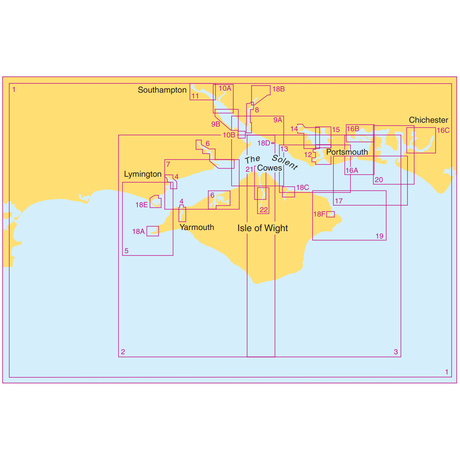
Admiralty Small Craft Charts 5600: Full Folio - The Solent and Approaches
In stockSale price £97.90 Regular price £391.60Unit price -

Admiralty Small Craft Chart 5600_1: Outer Approaches to the Solent
In stockRegular price £17.80Unit price
Admiralty Small Craft Chart 5600_2: Western Solent and Approaches
In stockRegular price £17.80Unit price
Admiralty Small Craft Chart 5600_3: Eastern Solent and Approaches
In stockRegular price £17.80Unit price


Admiralty Small Craft Chart 5600_7: Yarmouth to Beaulieu River
In stockRegular price £17.80Unit price

 New Edition
 New Edition

Admiralty Small Craft Chart 5600_12: Entrance to Portsmouth Harbour
In stockRegular price £17.80Unit price


Admiralty Small Craft Chart 5600_15: Portsmouth Harbour, Approaches to Port Solent
In stockRegular price £17.80Unit price

Admiralty Small Craft Chart 5600_17: Approaches to Langstone and Chichester Harbours
In stockRegular price £17.80Unit price
Admiralty Small Craft Chart 5600_18: Harbours, Creeks and Anchorages in the Solent
In stockRegular price £17.80Unit price
Admiralty Small Craft Chart 5600_19: Eastern Approaches to the Solent
In stockRegular price £17.80Unit price